BLM Dispatch #52 - My Daughter's First Backpacking Trip, Part 2
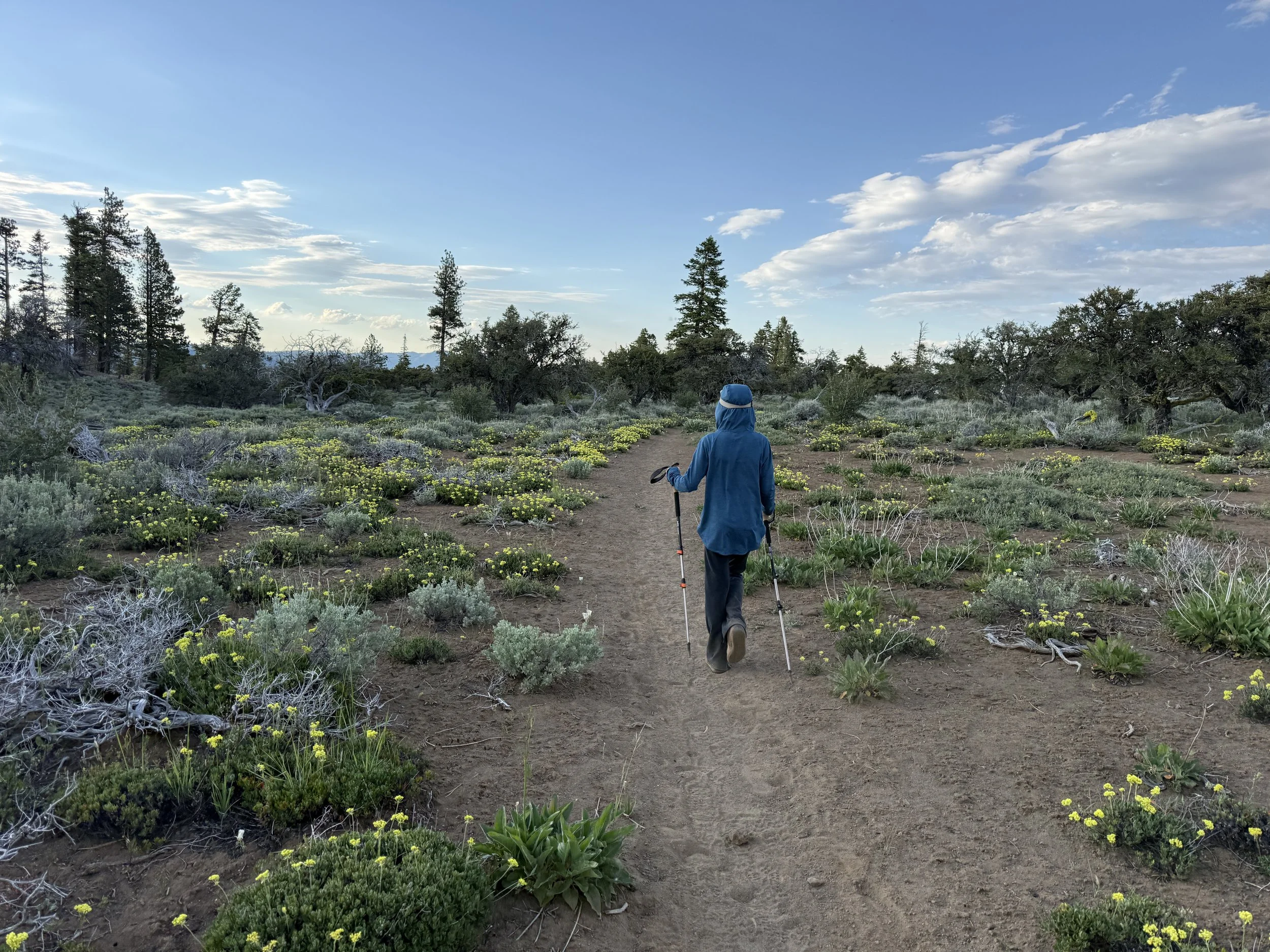
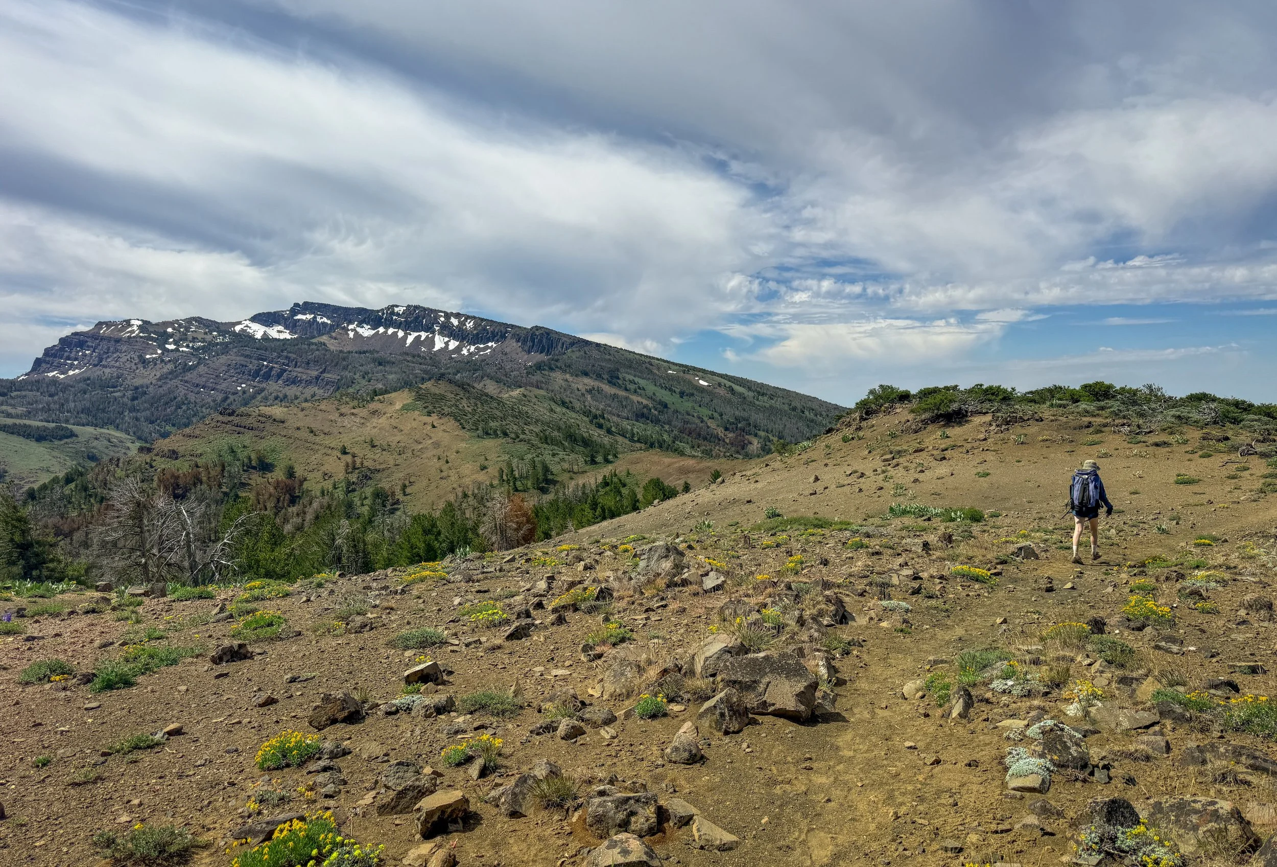
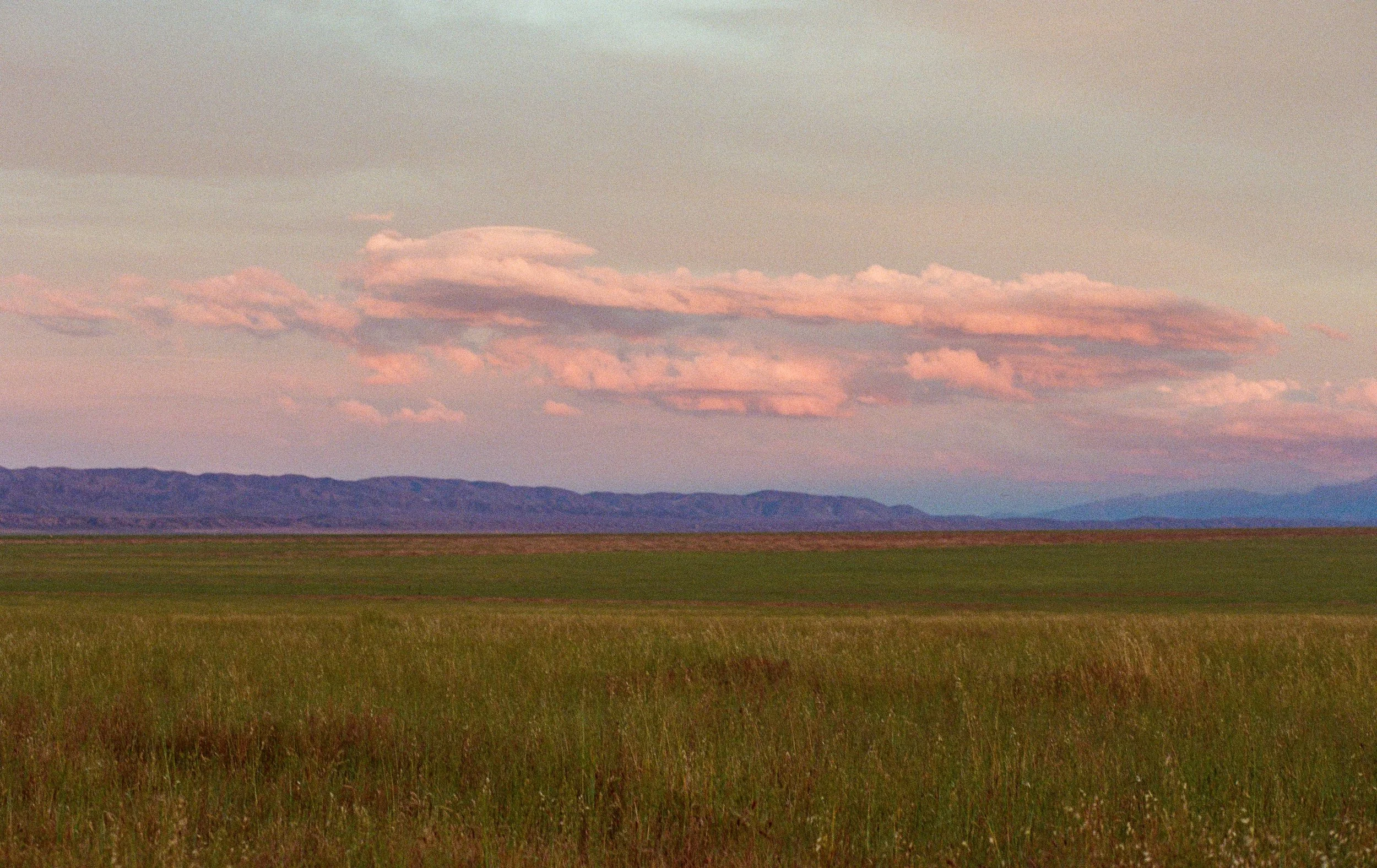
At 7:38 a.m. we shouldered our packs and walked toward the trailhead. The trail to Patterson Lake climbed six miles and 2,460 vertical feet. We tightened our pack straps, fist bumped the leaning wooden Wilderness sign, and started uphill.
That was how the day started. I didn’t know we’d also be finishing the day at the same trailhead. But I’ll get to that…
On fatherhood, red flag weather warnings, and making last second decisions with a 5th grader.
—
BLM Dispatch #51 - My Daughter's First Backpacking Trip, Part 1
Several months back, my 11-year-old daughter Vivian asked if we could go on her first real backpacking trip together.
After resisting the urge to weep and then run outside and hoot and holler and howl at the moon in gratitude — DREAMS COME TRUE! — I offered a very cool and relaxed, yes.
Where do you want to go?
One of those tall mountain lakes with clear water.
I immediately had a landscape in mind…
—
BLM Dispatch #50 - Books, books, books
Something a little different this week. Fifty dispatches feels like a good excuse to spend an entire newsletter talking about books.
I’ll start with my reading so far in 2026, which has been heavily influenced by a single obsession: the Great Basin.
If a book is about the Great Basin, set in the Great Basin, adjacent to the Great Basin, or can be connected to the Great Basin through an elaborate series of mental gymnastics, it’s on my list.
Plus, A Collection of My Favorite Books…
—
BLM Dispatch #49 - Soldier Meadows Road, Nevada
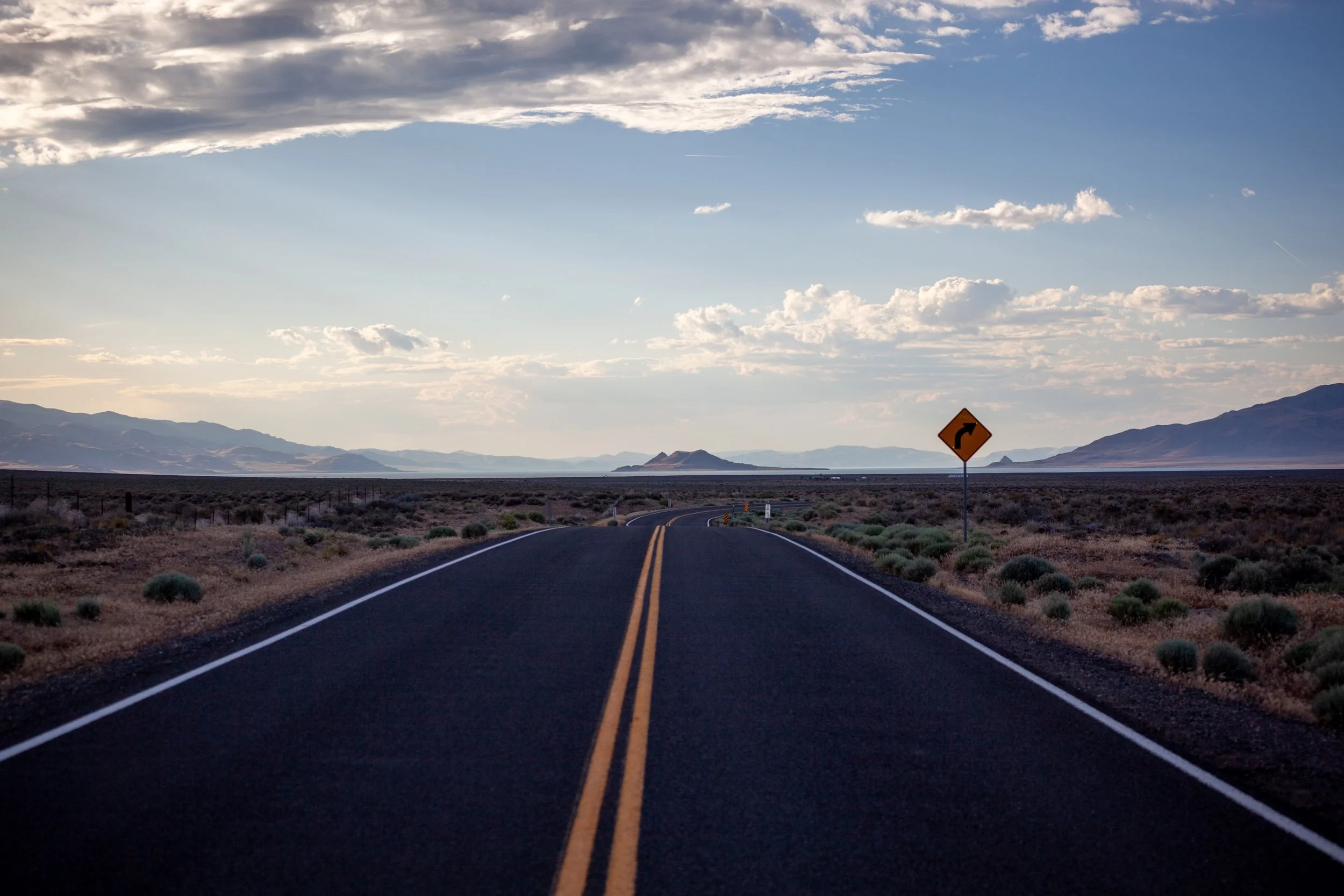
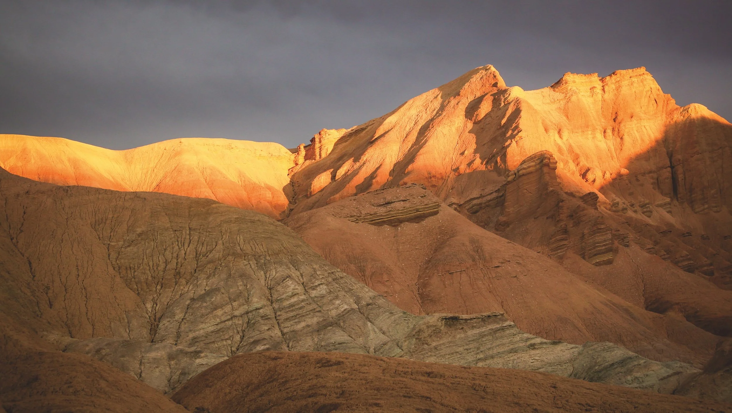
Suddenly the lake appears. Pyramid Lake. Kooyooe Panunadu to the Northern Paiute, the largest remnant of Lake Lahontan, which covered most of Northern Nevada 12,500 years ago. A geological millisecond in the timeline we find ourselves in.
Anaho Island is perfectly lit by a falling sun. 6:58pm. I stop the car right on the road, step out, place my camera on a tripod and take a few photos.
7:41 p.m. A few miles before Gerlach, a pair of pronghorn stand just beyond the shadow. Male and female.
Though I encounter them on nearly every trip to the Great Basin, their presence still gives me pause. They are the second-fastest land animal on Earth, still carrying the speed and endurance that evolved to outrun American cheetahs and other Ice Age predators. Unlike cheetahs, however, they can sustain those speeds over long distances — the marathoners of the animal world. Every encounter feels a little improbable, as if a fragment of the Pleistocene has wandered into the present…
—
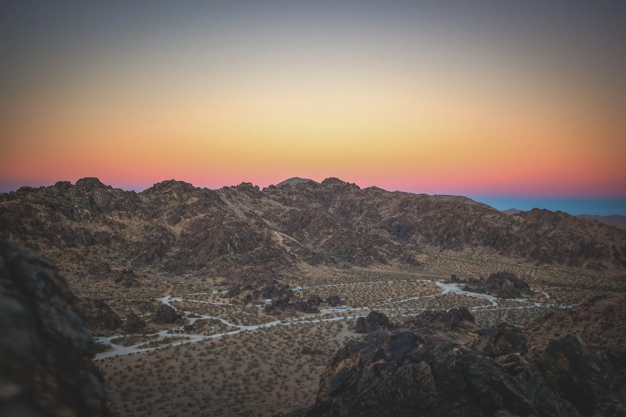
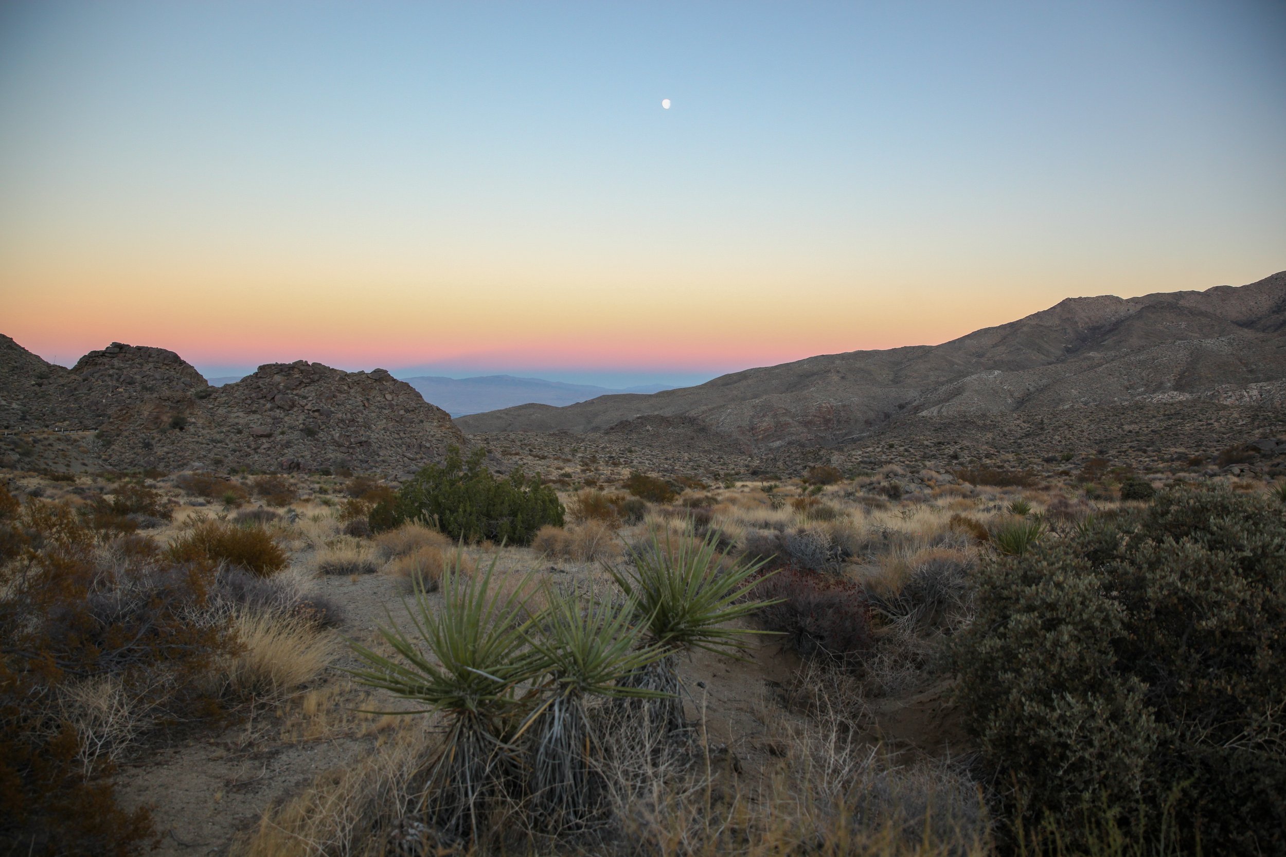
BLM Dispatch #48 - BLM Campgrounds in the Mojave and Colorado Deserts
Over the past six months, we’ve traveled together across the Mojave, Sonoran, and Colorado deserts of the American Southwest. But every desert season eventually comes to an end, and though people live in the desert — and though the temperatures haven’t yet reached their true boiling point — every May my body, brain, and spirit begin quietly saying goodbye.
I have already covered the BLM campgrounds in California’s Eastern Sierra in Dispatch #5, but now to close out the season, I wanted to shift to some of my favorites in California’s Mojave (and Colorado) deserts…
—
BLM Dispatch #47 - Santa Rosa and San Jacinto Mountains National Monument
Well, we’re at the edge of desert season now. The mesquites are pushing out their feather-like leaves, rattlesnakes are emerging from dens, and daytime temperatures are climbing well past what feels reasonable.
This week’s dispatch takes us to the Santa Rosa and San Jacinto Mountain National Monument, where public lands rise abruptly from the Coachella Valley floor to elevations nearing 11,000 feet — protecting an astonishing transition from creosote flats and palm oases to alpine forests and snow-covered peaks.
Jointly managed by the BLM and U.S. Forest Service, the monument contains a vast network of campgrounds, canyons, trails, and wilderness areas. Near the desert floor sits a surprisingly excellent visitor center — the kind more commonly associated with national parks than BLM land — complete with interpretive exhibits, maps, helpful staff, and a much appreciated blast of air conditioning before heading back into the heat…
—
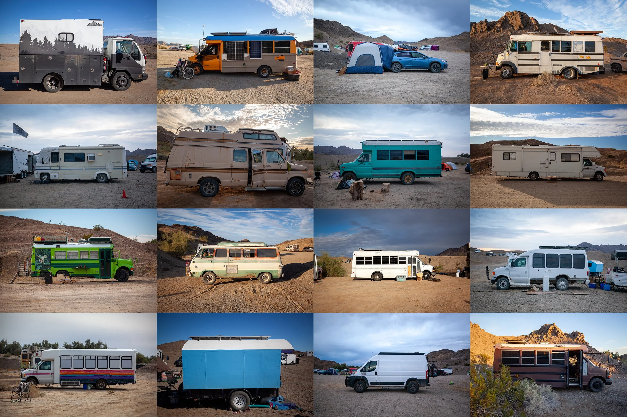
BONUS - My Feature Story on Nomads
A quick note here — after three months of reporting, two camping trips into the desert, and dozens of interviews, my feature on nomads living on public lands was published this week.
I’m really proud of how it came together. It’s hard to overstate what a privilege it was to spend time with this community — to share space, listen, and learn from people whose stories are so often overlooked or misunderstood.
The piece was co-published by The Guardian and RE:PUBLIC, and if you have twenty minutes, I think it’s worth your time.
From the essay —
For generations, the American promise has been tied to settlement – a deed, a mortgage, a fixed address. But the winter nomadic community reveals a different model of permanence, one defined less by walls than by movement, less by ownership than by return…
I’ll be back to regularly scheduled programming this Sunday.
—
Dispatch #46 - A Few Hundred Nights
I’ve been thinking a lot about my tent this week as it just arrived back to me from Big Agnes after being in for repairs.
It’s the Copper Spur UL2 Tent.
I purchased it for $279.93 back in 2016, a week after the ballots were cast. A grief gift, I called it then.
It’s been sent in twice for repairs: first for bent poles, and most recently for zipper issues and tiny holes punctured by embers (I remember the night I pitched it too close to the fire, when a sudden wind sent up embers that burned holes in the tent and in my pants)…
—
Dispatch #45 - Anti-Superbloom on the Carrizo Plain
Spent another spring in the Carrizo Plain National Monument.
This year marks five in a row:
2022: Severe drought. Soda Lake a salt crusted, unwatered moonscape. A few sunflowers in the Temblors, pockets of silver lupine in the Calientes. Highlight: Watching a San Joaquin kit fox mother and her three kits playing on the valley floor (I haven’t seen any since)…
—
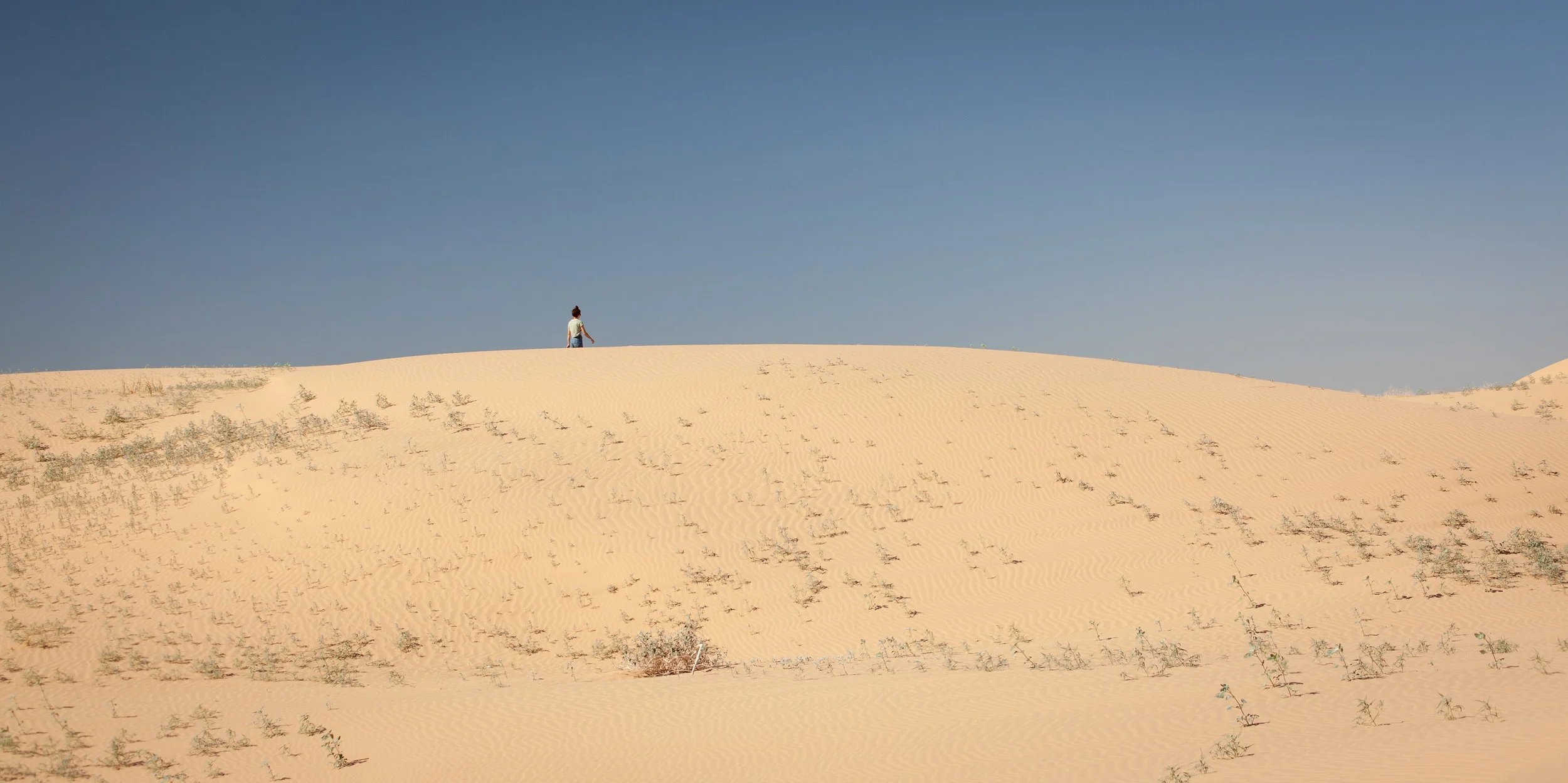
Dispatch #44 - Algodones Dunes
Have you heard of the Algodones dune system? At eight miles wide and forty miles long, it’s one of the largest dune fields in North America, stretching from east of the Salton Sea, over Interstate 8, and into Mexico. Within it lies the Imperial Sand Dunes Recreation Area, a managed portion overseen by the BLM. It’s here that off-highway vehicles are permitted, and where the landscape feels most shaped by use—the most visited, the most developed, and, for many, the most familiar version of the dunes.
I first visited in early 2021 while working on The Enduring Wild. It was, in every sense, a strange time to be out there. Covid was surging. Vaccines were still on the horizon. January 6 was less than a month old. The mask wars were deepening. Angst was the mood of the day…
—
Dispatch #43 - Chuckwalla National Monument Part 2
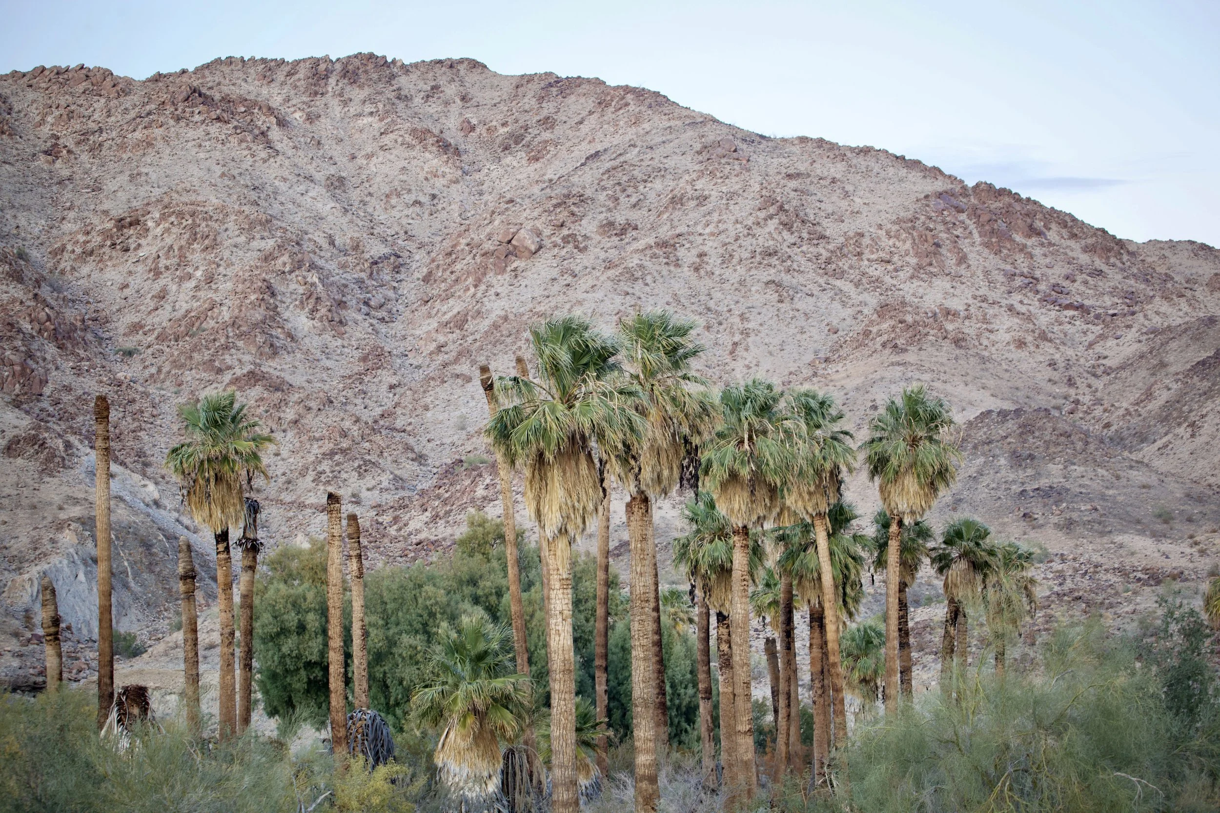
I have spent a lot of time wandering this small patch of land over the years, learning its contours both on foot and on the map. Its shape is an imperfect circle, 9.6 miles in circumference, enclosing roughly 3,382 acres of rocky ridges, sandy washes, and hidden oases centered around Corn Springs, a loop of green where trees, shrubs, cacti, and wildflowers hold their ground against the desert.
The dark yellow marks BLM land designated as Wilderness, the highest level of protection we have for land in the United States. The aqua square is California State Lands. The small gray parcels are privately owned, held by miners who laid claims here long ago.
And that light patch of yellow where I’ve been roaming, the area roughly encircled in red on the map, was BLM land without formal protections.
That changed with the creation of Chuckwalla National Monument. More than 624,270 acres in California’s southeast corner now carry a shared name and a shared protection, bringing together long-designated Wilderness with 375,747 acres of previously unprotected BLM land.
—
Dispatch #42 - Chuckwalla National Monument Part 1
One of the first treks I made onto BLM land was to a place called the Mecca Hills Wilderness, largely because the agency website promised hiking trails (back in 2020, I was new to the world of BLM lands, and trails were my gateway drug). I saw photographs of ladders in a place called Painted Canyon and was instantly hooked.
I’ve been returning ever since.
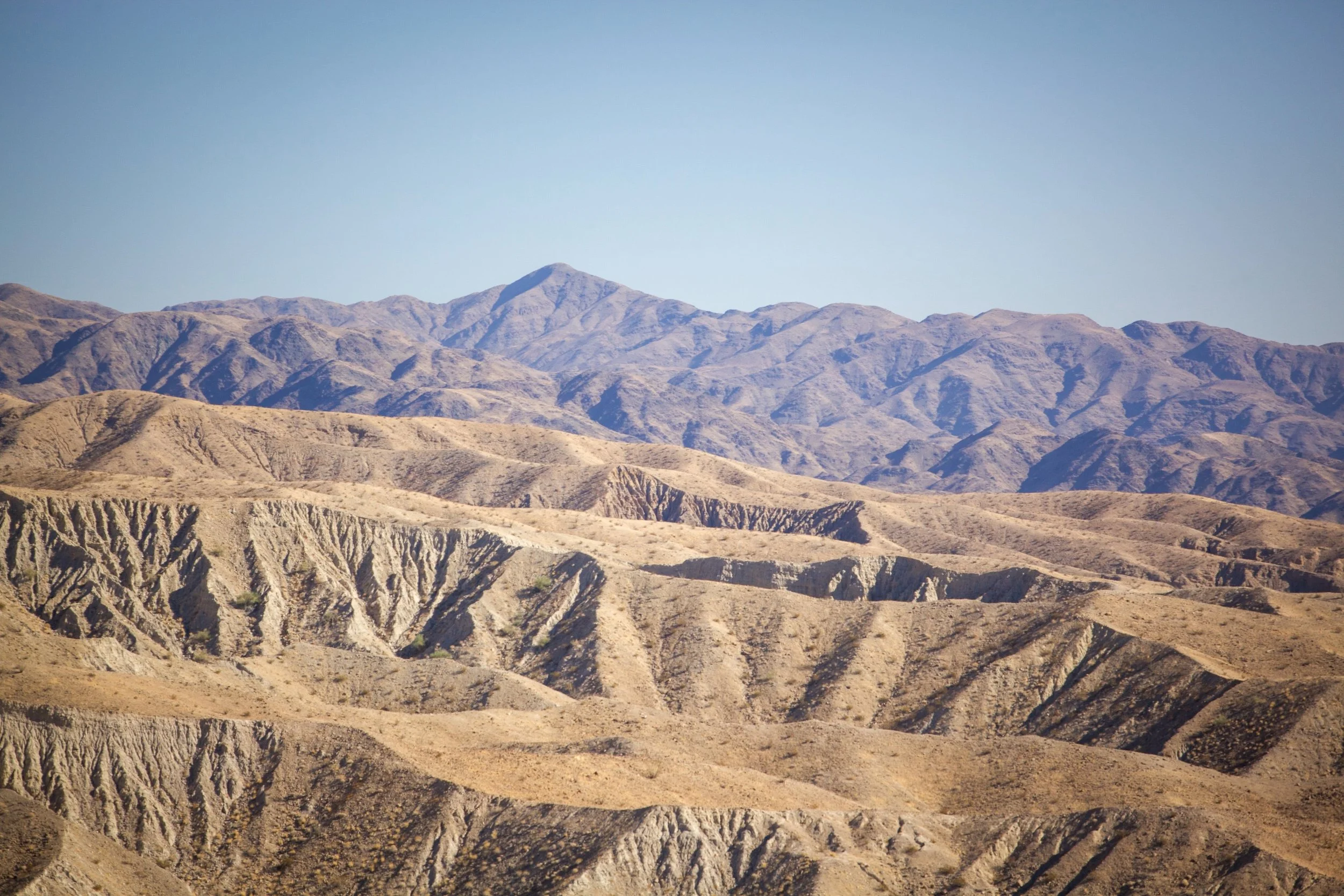
The Mecca Hills Wilderness sits inside the western edge of the Chuckwalla National Monument, near the end of its witch-like pointed finger. This is Wilderness with a capital W — 26,242 acres designated under the landmark California Desert Protection Act of 1994.
After more than fifty revisions between 1986 and its passage, the bill moved through the Senate by a 68–23 margin and permanently reshaped the conservation landscape of the California desert. It created Death Valley and Joshua Tree as national parks, established the Mojave National Preserve, and designated sixty-nine new wilderness areas, including Mecca Hills…
—
Dispatch #41 - The Amargosa Wild and Scenic River
If I were to tell you about a “wild and scenic river,” what kind of images would that conjure? Raging rapids careening through granite boulders? A broad tributary sliding beneath evergreen forests? That is what I used to picture when I heard the phrase. My grandiose idealism defined wild as untamed and scenic as the kind of picturesque beauty that is universally praised and accepted.
But the reality of what qualifies as “wild and scenic” is far more surprising.
There are only ten federally designated, BLM-managed wild and scenic rivers in California — just 124.2 miles in total length.
The second longest of these runs through the heart of the Mojave Desert, past a famous valley named Death and a mountain range named Funeral, where summertime temperatures hover in the triple digits for months on end.
The diminutive Amargosa River.
—
Dispatch #40 - US Route 95, Arizona
Good morning from the road. Well, from my tent, actually. It’s 1:42 a.m.
Woke up in a state of frenzy, my dreams speaking falsehoods about losing the hundreds of photographs snapped during the day for a story I’m working on.
I opened my eyes in the morning darkness, overheated, sweat running like streams across my chest, and squirmed free from the mummy bag. Found my camera by headlamp and flipped it on to see all the photos intact.
Let out a long sigh of relief and fell back onto my pillow.
Ripped off my jacket and shirt.
Wide awake. Thoughts spin…
—
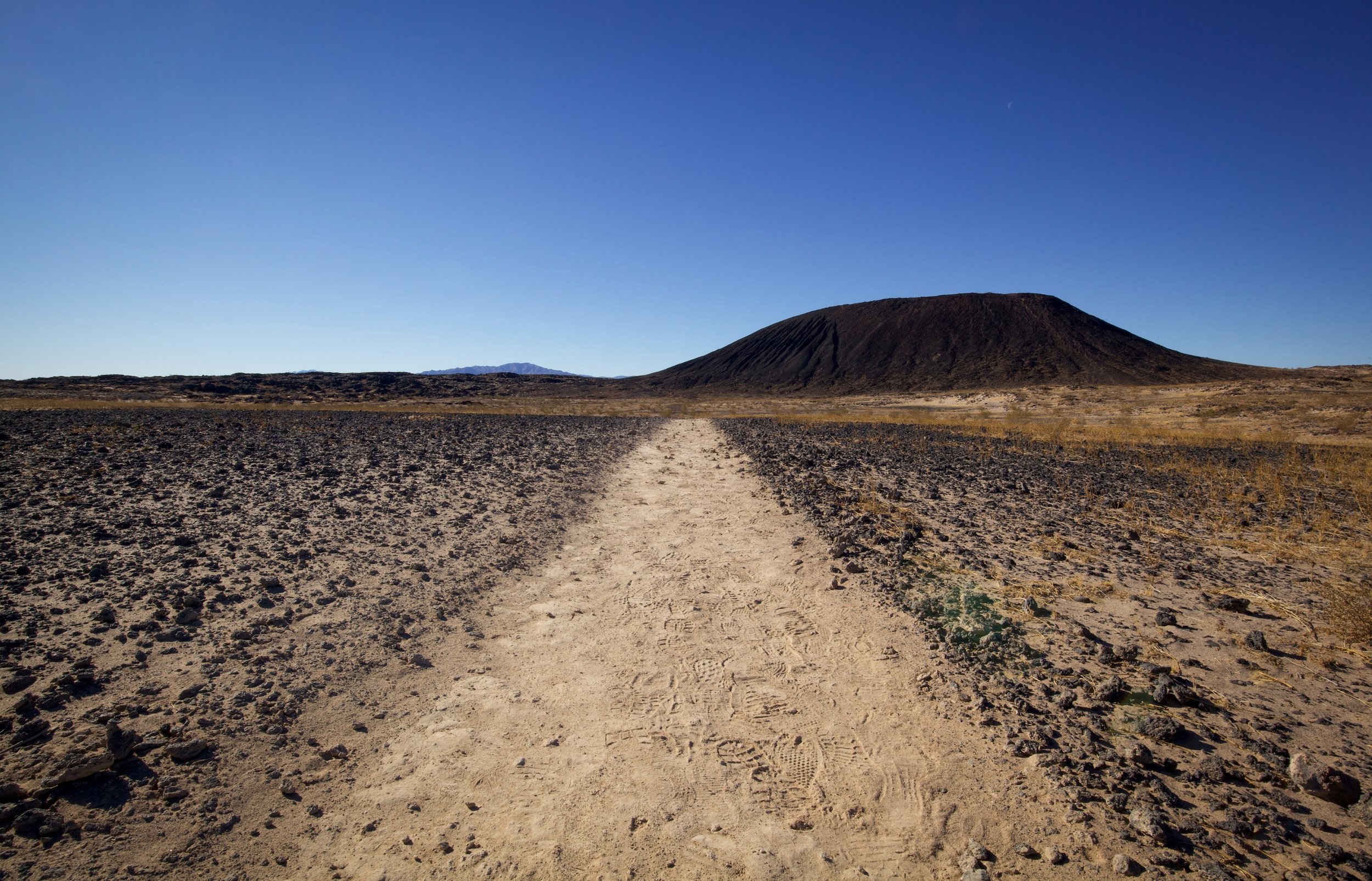
Dispatch #39 - Climbing Inside the Amboy Crater
ou first spot the Amboy Crater from Route 66 as a dark speck rising from the flat Mojave floor. At that distance it barely registers, a small interruption in an otherwise endless horizon. But mile by mile, it grows as you pass ghost towns with names like Klondike, Siberia, and Bagdad, until the black cinder cone dominates the landscape, looming in full view, as if it could wake up at any moment.
Nearly 79,000 years ago, it did exactly that. Molten lava erupted from what is now a quiet, extinct volcano, spilling across the desert and carving out the basalt plains that still surround the cone today. The most dramatic remnant of that eruption is the breach on the crater’s western side, where lava once surged outward. Now, that break in the cone serves as the gateway into the crater itself.
As you approach the crater’s edge, the scale snaps into focus. What looked like a simple mound from the highway suddenly drops away beneath your feet, revealing a vast, bowl-shaped interior. Walking down into the crater feels strangely intimate, like stepping into the hollowed-out heart of the earth. It’s dreamy and otherworldly to realize you’re standing inside the center of an extinct volcano, tracing the contours left behind by fire and time.…
—
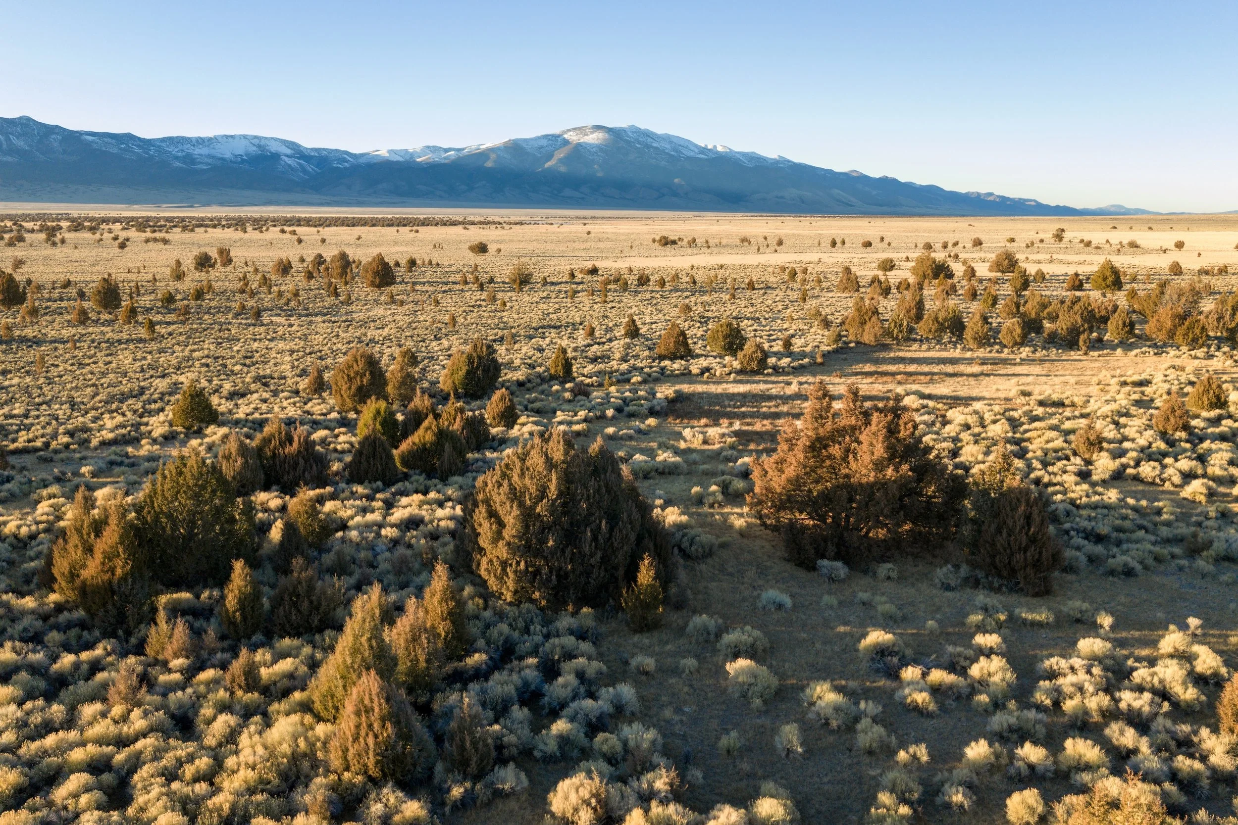
Dispatch #38 - A Valley Called Bahsahwahbee
A pot of elk chili was on the stove when we arrived, simmering, gurgling, steam rising like campfire smoke. Corn bread baked and cooling. Salad bowl filled, tongs resting on lettuce. The cabin smelled of onions and toasted butter, the scent of a kitchen that’s been working all afternoon. We shook hands with our hosts, handed over bottles of wine and champagne, and the four of us sat by the wood stove in rocking chairs, our glasses clinking to good weather and the mounted bull elk hanging off the wall, the same elk we’d be having for dinner.
Cheers, we said in unison.
Bahsahwahbee is a valley in eastern Nevada, on public land managed by the BLM, where water rises unexpectedly from the ground, feeding a rare grove of Rocky Mountain juniper whose roots braid through wet soil in a landscape otherwise defined by aridity. Springs surface and disappear again, sustaining the grove through years of drought and heat. For the Newe, these trees are not simply old; they are alive with meaning, a gathering place where ceremony, memory, and relationship have long taken root…
—
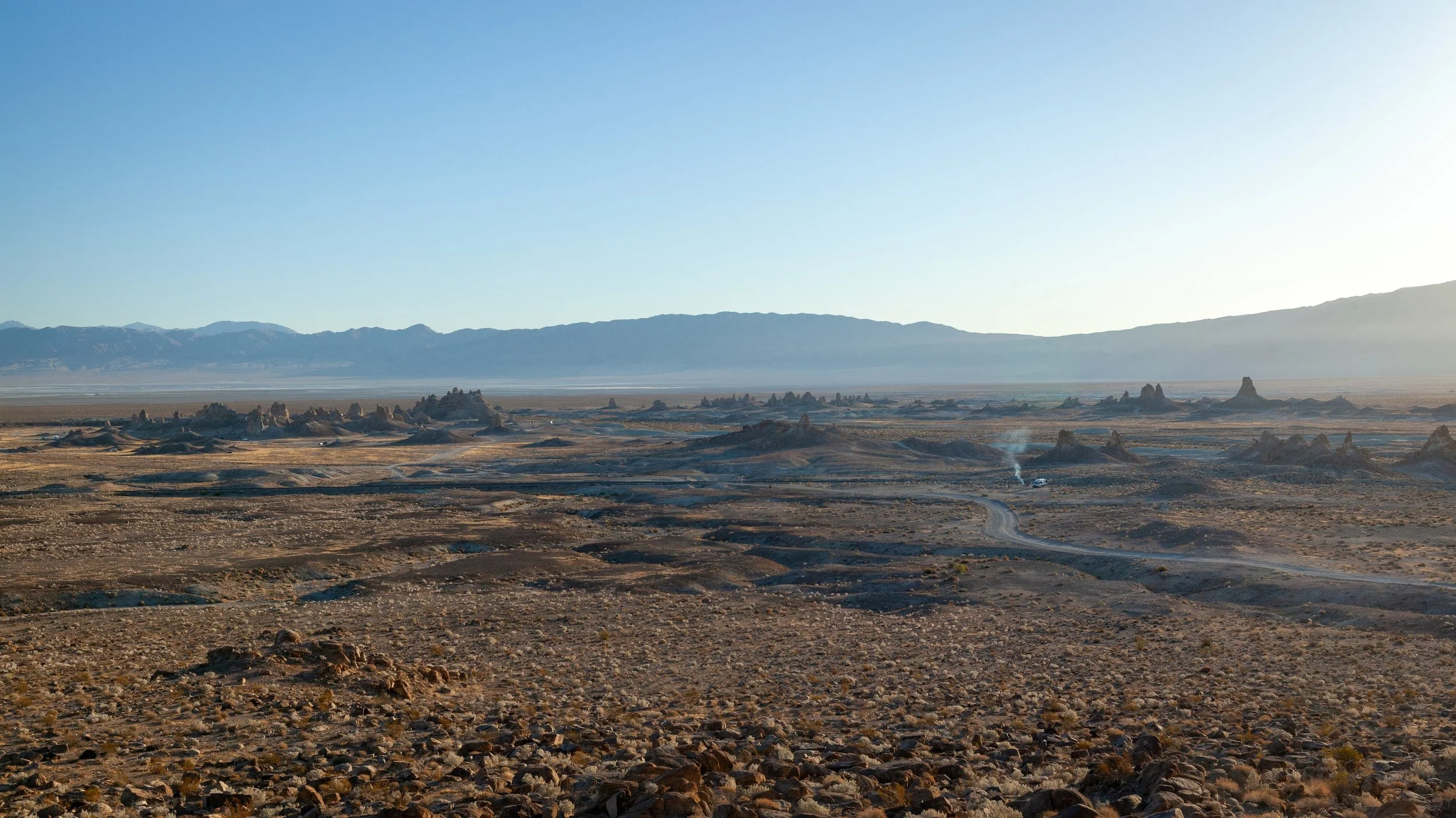
Dispatch #37 - The Trona Pinnacles
This month marks the 11th anniversary of a random January camping trip I took in 2015 — one that would eventually rearrange the trajectory of my life.
I’m not sure which rabbit hole I fell into on the antiquated BLM website that led me to the Trona Pinnacles, but of all the tunnels I could have crawled into while looking for a place to camp, I’m sure glad it delivered us to those ethereal tufas.
We left Los Angeles on New Year’s Day, 2015 — my kids in car seats, my wife at home with our newborn. I remember thinking that no matter how this impromptu camping trip turned out, or what the Pinnacles looked like, we were going to have some kind of adventure. And that seemed to matter as much as anything.
Four hours later we arrived to the gravel entrance off Highway 178. We stretched, ran around, read the welcome signs, and then hopped back in our Element for the final six mile drive that would take us to the heart of the landscape.
—
Dispatch #36 - A few of my Favorite Things from 2025
At the end of every year, I spend a few days taking inventory — an annual reflection on the people, trips, books, stats, images, and pop culture that shaped my year. It helps slow down time, but it also lends some wisdom and discernment as I plan for the year ahead.
One of those exercises is simply to ask: what sparked joy?
So here are just a few of my favorite things from 2025, outside of, you know, family and friends and the astonishment of having my own book released into the world.
—
